Cookie Consent by Free Privacy Policy Generator Garmin G3 Vision Small - VEU508S - Kristians and Haugesund Ryfylke (010-C1070-00)
Cactus Navigation Logo
Contact Cactus Navigation
Magnifying Glass
Bank Holiday: We will be closed on Monday 25th May. Orders placed over the weekend will not be dispatched until Tuesday 26th May.
Low Prices, Free Delivery, Expert Advice, Unbeatable Service.

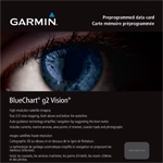
Garmin G3 Vision Small - VEU508S - Kristians and Haugesund Ryfylke

Manufacturers Part Number: 010-C1070-00
Garmin G3 Vision Small - VEU508S - Kristians and Haugesund Ryfylke

Garmin G3 Vision Small - VEU508S - Kristians and Haugesund Ryfylke Image (1)

Our Price:
£189.95 Inc VAT
£158.29 Ex VAT
Order Code: ZGAR010-C1070-00
Manufacturer: Garmin Charts
RRP: £220.00 Inc VAT
In Stock National Distribution Hub
Ready to ship or collect from Plymouth within 48hrs.

Delivery Options
Choose Destination
Postcode/ZIP:  

Priority Service
Transit Time 2 - 3 Working Days.
(inc TAX)
£5.94

Economy Service
Transit Time Up To 7 Working days
(inc TAX)
FREE

Click&Collect
Collection from Plymouth in 48hrs
(inc TAX)
FREE


Garmin G3 Vision Small - VEU508S - Kristians and Haugesund Ryfylke

PLEASE NOTE: ELECTRONIC CHARTS ARE PROGRAMMED TO ORDER - THEY ARE NON RETURNABLE AND NON REFUNDABLE.

PLEASE ENSURE YOU ARE ORDERING THE CORRECT FORMAT AND AREA FOR YOUR CHART PLOTTER - IF YOU ARE UNSURE, PLEASE CONTACT OUR SALES TEAM.

See your vessel’s precise, on-chart position in relation to navaids, coastal features and restricted areas with premium features found in this detailed marine mapping data. Includes all of the features of our BlueChart® g3 product, plus 3-D perspective above and below the waterline, Auto Guidance, high-resolution imagery, and aerial photos of ports, harbors, marinas and landmarks.

-Shaded depth contours, coastlines, spot soundings, navaids, port plans, wrecks, obstructions, intertidal zones, restricted areas and IALA symbols.

-Seamless transitions between zoom levels and more continuity across chart boundaries.

-High resolution satellite imagery for a realistic view of the land and water.

-Aerial photos of ports, harbors, marinas, waterways, navigational landmarks and other POIs.

-Auto Guidance technology searches chart data to suggest the best passage to a destination.

-MarinerEye view 3-D perspective for a quick, easy position fix.

-FishEye view 3-D perspective for an underwater view of the sea floor.

-Safety Shading* enables contour shading for all depth contours shallower than your defined safe depths.

-Fishing Charts* to scope out bottom contours and depth soundings with less visual clutter on the display.

-Plan and organize routes from your computer with HomePort™


Detailed coverage of the Norway coast from Kristainsand to Haugesund including Mandal, Stavanger and the Ryfylke region.


There are currently no reviews for this product.

Click here to submit a review
Our Price:
£189.95 Inc VAT
£158.29 Ex VAT
Order Code: ZGAR010-C1070-00
Manufacturer: Garmin Charts
RRP: £220.00 Inc VAT
In Stock National Distribution Hub
Ready to ship or collect from Plymouth within 48hrs.

Delivery Options
Choose Destination
Postcode/ZIP:  

Priority Service
Transit Time 2 - 3 Working Days.
(inc TAX)
£5.94

Economy Service
Transit Time Up To 7 Working days
(inc TAX)
FREE

Click&Collect
Collection from Plymouth in 48hrs
(inc TAX)
FREE


Cactus Navigation Price Match Promise